
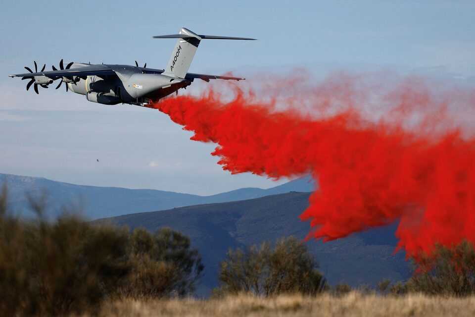
France plans to use an Airbus A400M aircraft for the first time in place of Canadair water bombers.
Faced with "an exceptionally intense start to the 2026 forest fire season," France is bolstering its firefighting resources.
This decision comes as more than 25,000 hectares have already burned since the beginning of the year, double the area affected during the same period in 2025.
The French Director General of Civil Security announced that the A400M will be used this summer to fight forest fires.
Director General of Civil Security, Julien Marion:
"we will probably implement a new method of fighting forest fires this season, an innovative method: the use of the A400M aircraft which equips our armed forces, on which we will be able to install a high-capacity water drop kit of 20 tons, which represents the equivalent of three Canadairs."
At a press conference this Friday, July 10, the Director General of Civil Security, Julien Marion, announced the likely deployment of the Airbus A400M in addition to traditional resources such as Canadair water bombers.
The Airbus military transport aircraft can be equipped with a special kit allowing it to drop 20,000 liters of water.
“The tests were successfully completed last year, and given the very intense start to the season we are experiencing, discussions are underway with Airbus and the Ministry of the Armed Forces to make this deployment possible,” he explained.
The A400M, with its four 11,000-horsepower engines and 42-meter wingspan, offers unprecedented versatility for firefighting operations.
Additionally, the "Wildfire Sentinel", developed by Airbus, is a holistic, data-driven firefighting ecosystem that combines Airbus’ technology bricks (aircraft, communications and flight operations) with solutions from partner companies.
Its core capabilities are seamless data exchange via the collaboration platform Agnet and real-time tactical situation awareness. These capabilities improve coordination between emergency teams, enhance decision-making and protect the safety of aerial firefighting operations.
.jpg)
By aggregating optical imagery from light aircraft and UAS with Earth observation satellite data and terrain mapping, the system uses AI-enabled processing to provide a comprehensive tactical picture.

.jpg)