.jpg)
After notifying the liberalised Drone Rules 2021 through 229221.pdf (egazette.nic.in) dated 25th August, 2021, the Indian Ministry of Civil Aviation has released the airspace map ("Digital Sky") for drone operations in India to indicate the Fly and No-Fly Zones.
Jyotiraditya Scindia , Union Minister for Civil Aviation, took this to the twitter and revealed that the map has been successfully uploaded in the digital platform within 30 days period from the rolling out of the New drones Rule.
Giving wings to the imminent drone revolution at breakneck speed! @MoCA_GoI has successfully managed to release the airspace maps for drones within 30 days of rolling out the new Drone Rules, all thanks to the team, as well as stakeholders at the State & industry levels.
— Jyotiraditya M. Scindia (@JM_Scindia) September 24, 2021
You may like to read...The Drone Rules 2021
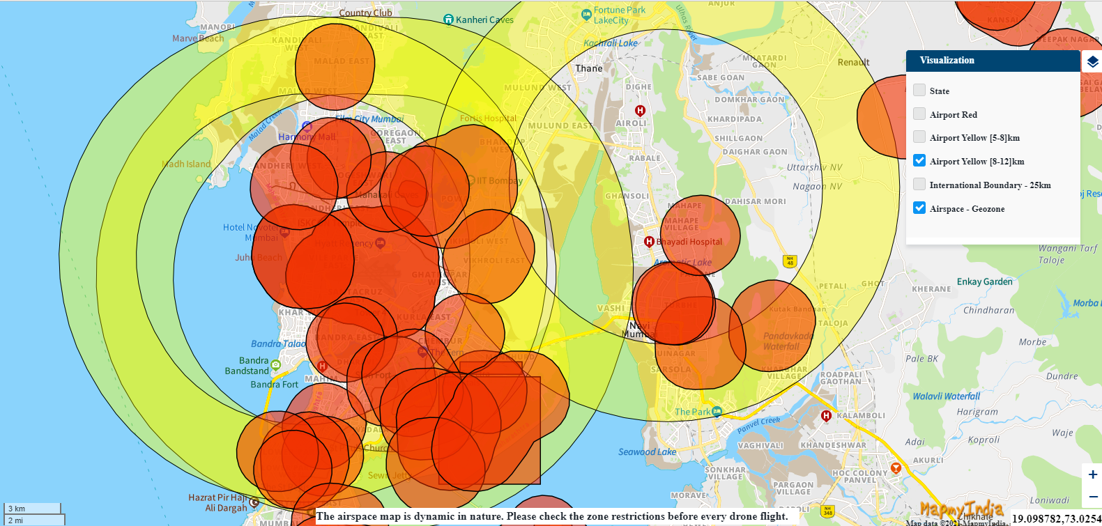
The MoCA (Ministry of Civil Aviation) says that the drone airspace map is an interactive map that "demarcates the yellow and red zones across the country".
Brief Description of Drone operation Zones in India are as below :
► The Green Zone :
The green zone is the vertical airspace up to 400 feet that has not been designated as a red or yellow zone and up to 200 feet above the area located between eight to 12 km from the perimeter of an operational airport. In green zones, no Authorization is required for operating drones with an all-up weight up to 500 kg, provided all other requirements such as registration , licensing requirements are complied with.
►The Yellow Zone :
The yellow zone is the vertical airspace above 400 feet in a designated green zone; above 200 feet in the area located between eight to 12 km from the perimeter of an operational airport, and above ground in the area located between five to eight km from the perimeter of an active airport or airstrip.
Operating a drone in the yellow zone will require authorization from the concerned "air traffic control authority" such as AAI, IAF, Navy, HAL as the case may be. Compared to the initial version (out dated) of the " Unmanned Aircraft System rule -2021, the yellow zone has been reduced from 45 km earlier to 12 km from the airport perimeter as per the new Drones rule 2021.
► The Red zone :
The Indian red zone is a ‘no-drone zone’ or No Fly Zone for the Drones due to the nature of sensitivity of the area , and drones in this zone can only be operated after receiving necessary authorization from the Indian central government.
The Ministry (MoCA) statement and "Digital Sky Plat form" also clarified that the Drone airspace map is Dynamic and may get modified by the “Competent authorities from time to time.” It also revealed that drone operators will need to check the latest airspace map mandatorily to keep a check on any changes in the zone boundaries.
Read More....